-40%

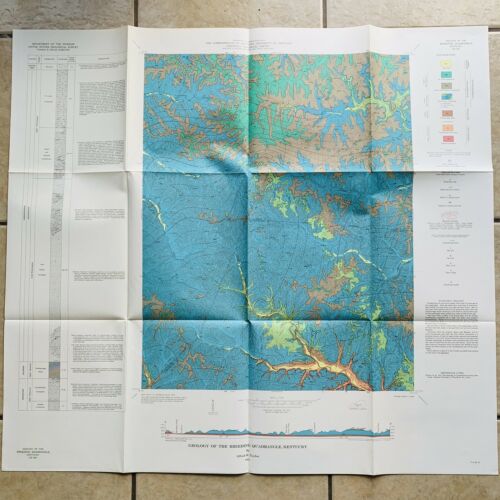
Adair County Kentucky Breeding Map United States Geological Survey USGS 1964

$ 5.26

Availability: 100 in stock
  • Item must be returned within: 30 Days
  • All returns accepted: Returns Accepted
  • Year: 1964
  • US State: Kentucky
  • Format: Folding Map
  • Date Range: 1960-1969
  • Type: Geological Map
  • City: Breeding
  • Cartographer/Publisher: USGS
  • Mexican State: N/A
  • Return shipping will be paid by: Seller
  • Refund will be given as: Money Back
  • Condition: Vintage condition, may have some damage, see photos
  • Country/Region: American States & Territories
  • Original/Reproduction: Vintage Original
  • Printing Technique: Lithography
  • Canadian Province: N/A
  • Restocking Fee: No

    Description

    United States
    Geological Survey Map
    USGS
    Alfred R Taylor
    Adair Cumberland County Kentucky
    1964
    Breeding Quadrangle
    32 3/4" x 30"
    Collector
    Deco
    Mancave
    Vintage condition
    may have some damage, see photos
    Will combine shipping
    on multiple orders